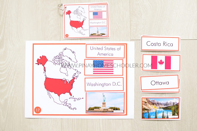
I've got new geography printables for you! This is a hands-on activity on maps and basic facts about the countries on each continent. You kids will have fun in learning and memorizing country locations, country flags, the capital cities and famous landmarks! (Purely memorizing is definitely boring!)
WHAT YOU WILL GET
- county maps for each continent (in Montessori colors)
- fact cards for each country (in Montessori colors)
- control sheets
THE MAP SHEETS and PUZZLE CARDS
The puzzle map sheets contain highlighted maps in red for each country that is featured. The sheets also contain numbering for error control.
Facts included in the puzzles are: country name, flag, capital city and a famous landmark.
Here are the number of countries featured in each continent:
- Asia - 42 countries!
- Europe - 40 countries!
- North America - 17 countries!
- South America - 13 countries!
- Oceania - 5 countries!
THE CONTROL SHEETS
These are full-page control sheets, but I prefer to use them as cards, so I set my printer settings to print 4 PAGES PER SHEET and this is how it looked like. I then bind them using these rings which you can buy in Amazon (or any school supplies store).
HOW WE ARE USING IT
I only printed and started working on the continents that we have visited (Asia, North America and Europe). Below is our typical set-up at home. I generally group all the country cards, flag cards, capital city cards and landmark cards and let the kids sort them out in the puzzle maps.
For best results, I printed these in photo paper sheets. I used beautiful and high quality images for our landmarks so the kids will really get to appreciate all those beautiful places in the world.


0 comments:
Post a Comment
Thanks for dropping by my blog! It really means a lot that you spare the time to read... and comment! Don't forget to check the "Notify Me" box so you will be notified of my response.